© 2012
December’s lack of snow in California forced us to consider other opportunities. Oregon opportunities. So, Mark Chon and I hopped in the Jeep and headed for the border.
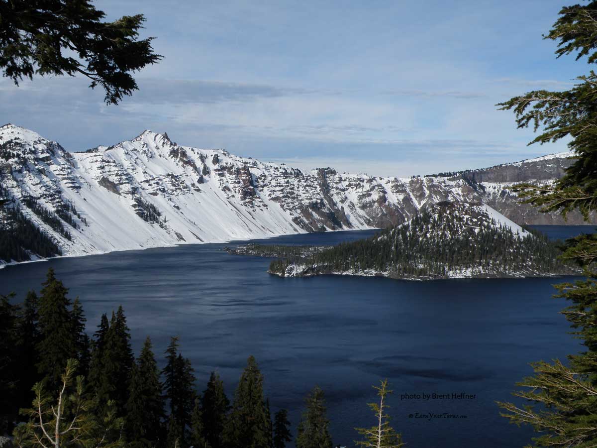
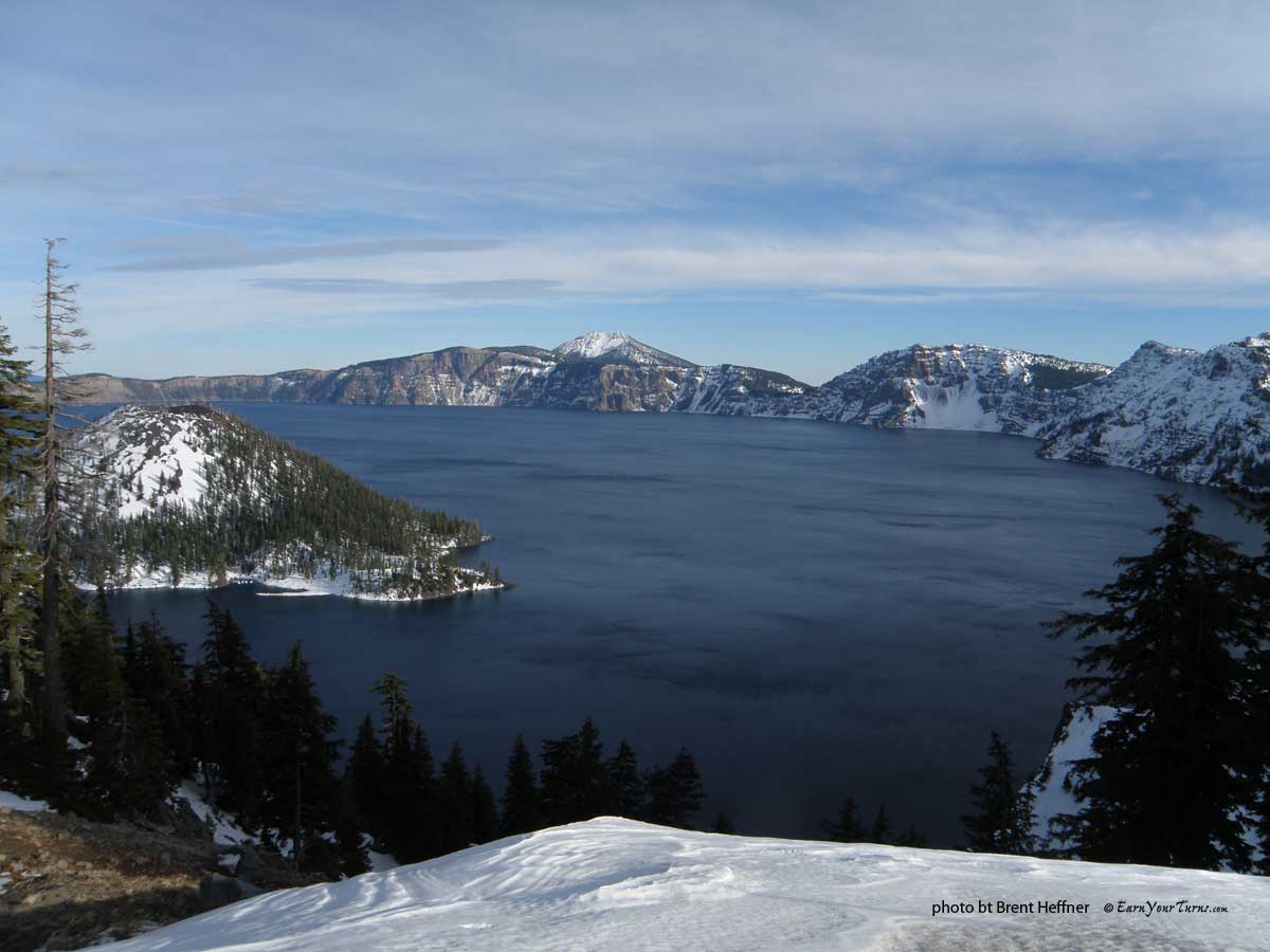
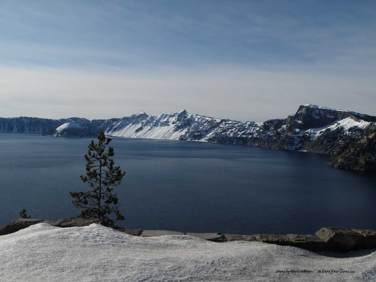
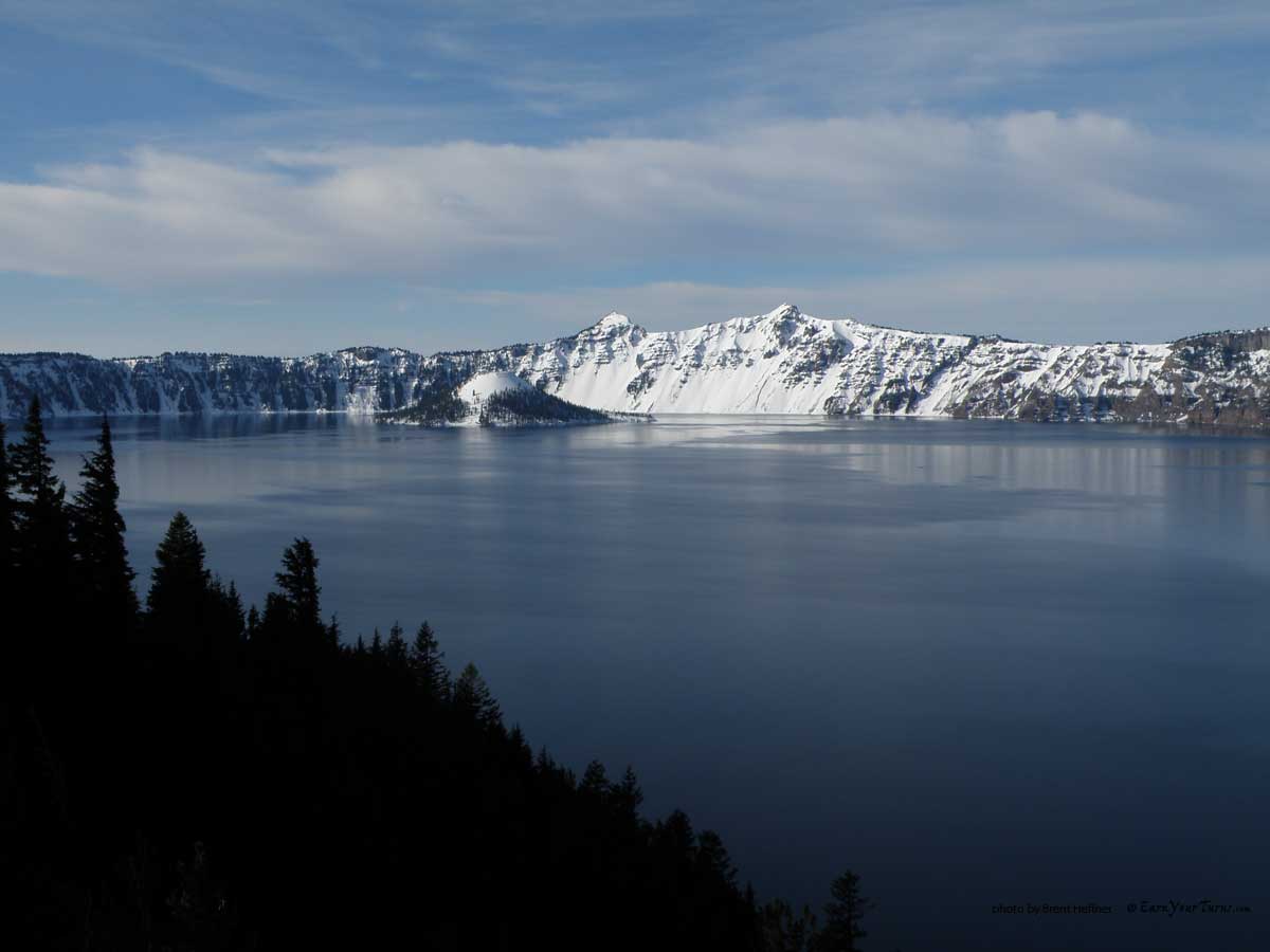
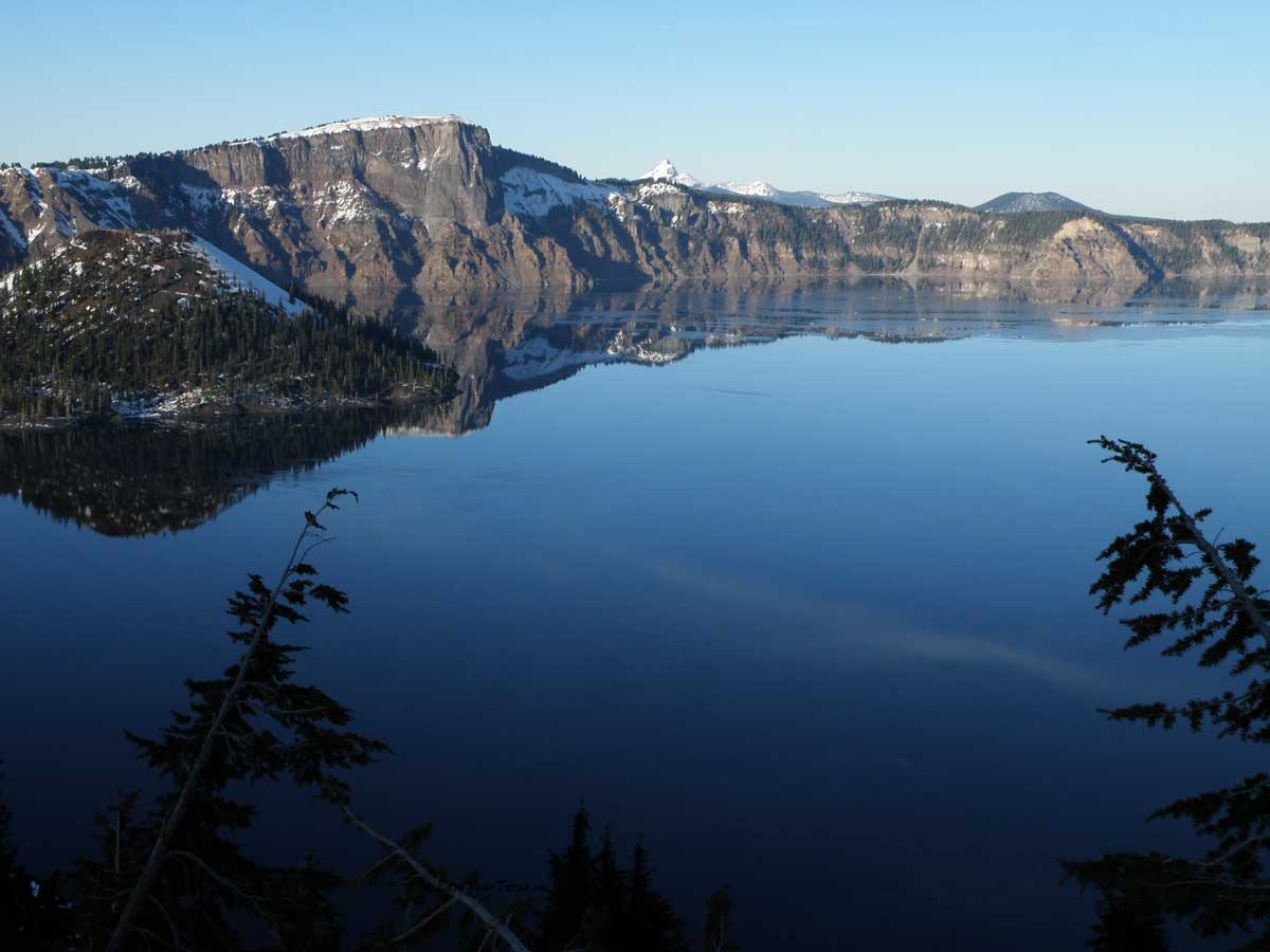
The view from Rim Village
We arrived at Rim Village on Wednesday, secured a permit and were off and jibbing by 1pm.
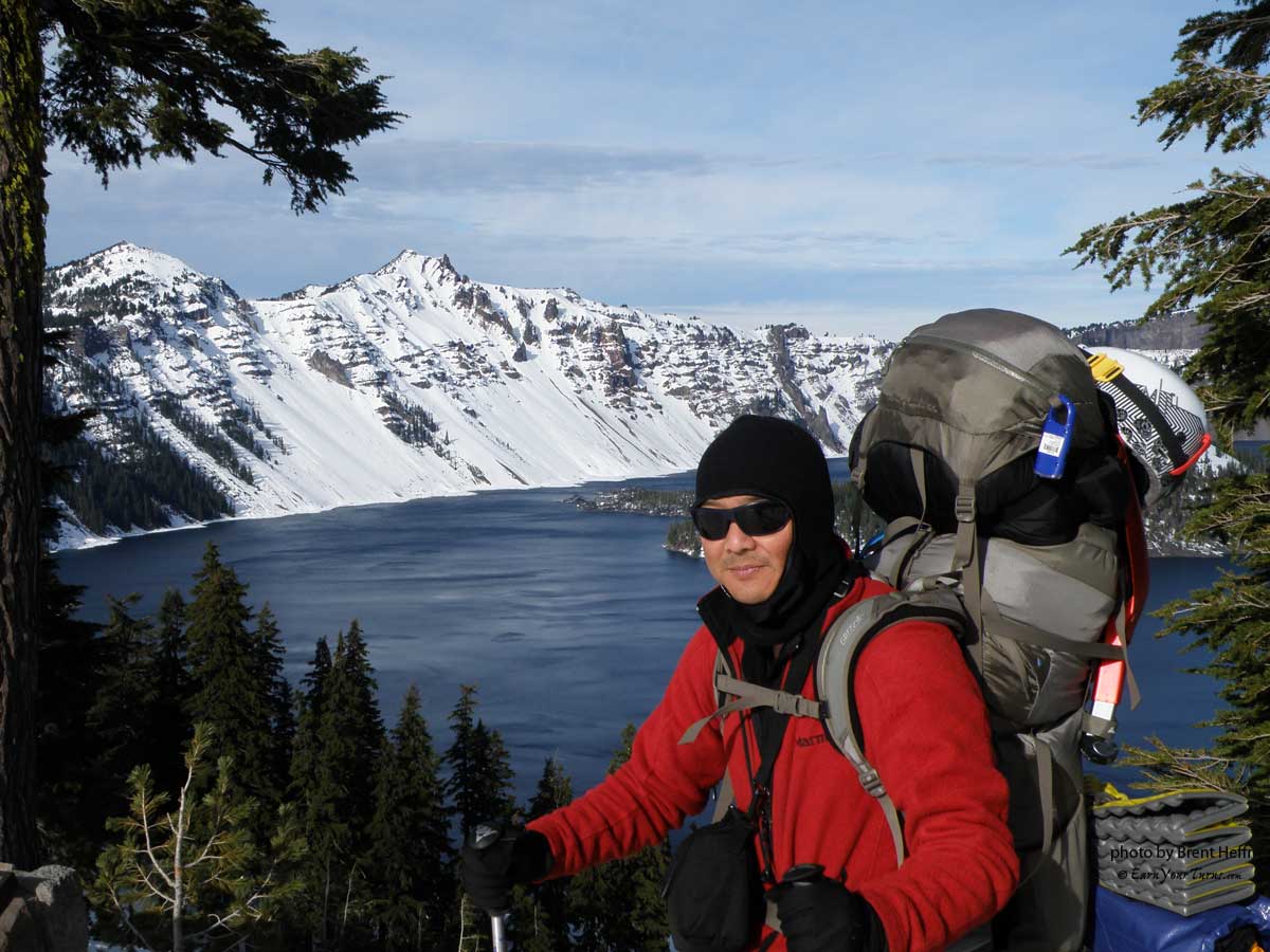
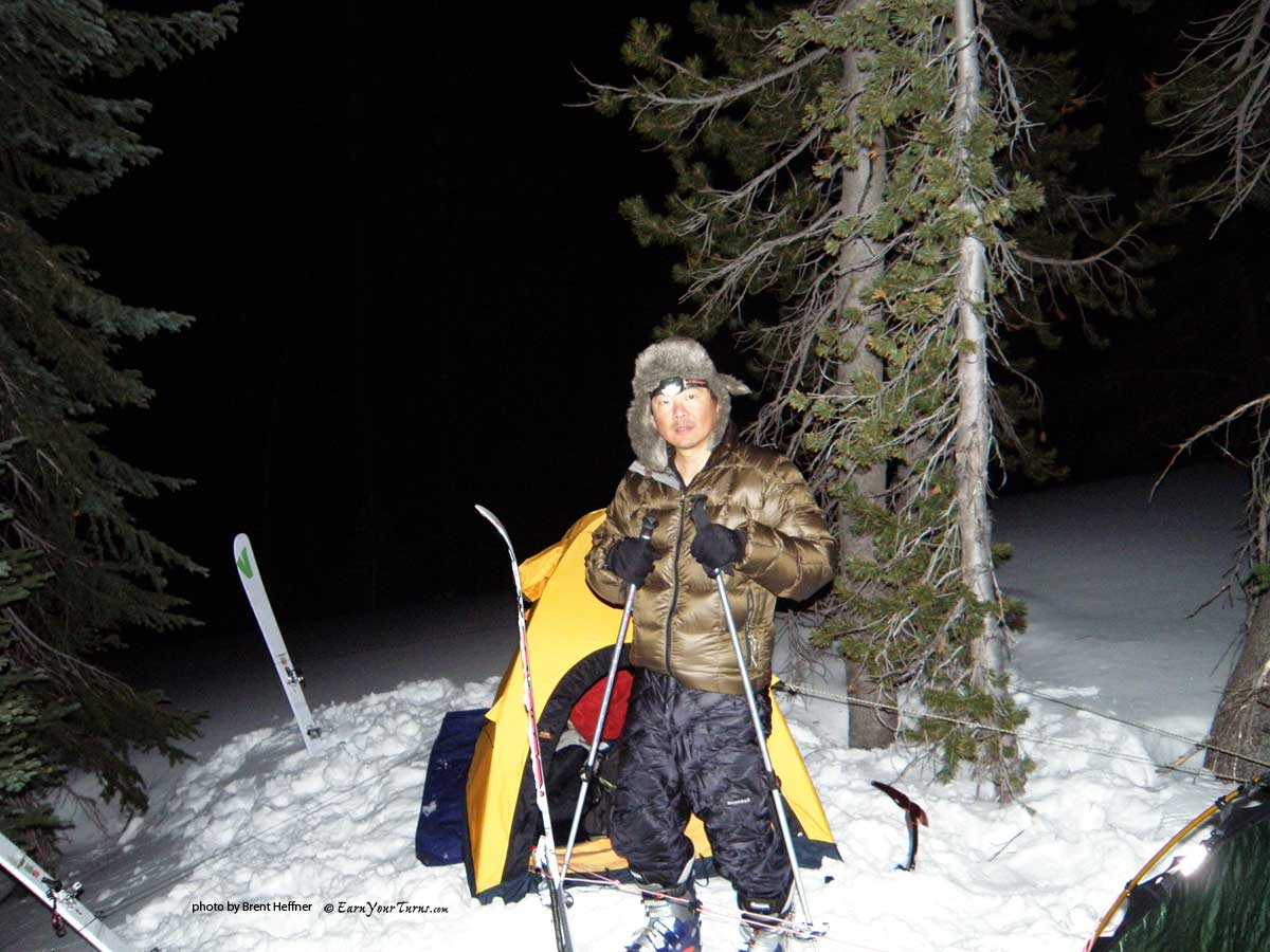
Mark ready to get his jib on.
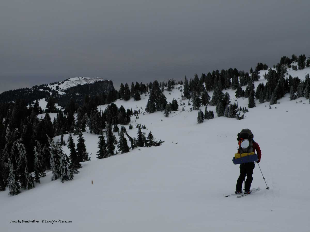
The new skis, Rossi BC 110 for me and Voile Vector BC for Mark, worked well. Freed from our skins, we glided, gripped and skated along, heading towards The Watchman – the peak on the left. The day was sunny but cold. The snow was about 3-4 feet deep. We were carrying 45 pound packs loaded with 5 days of food and some extra layers.
The weather called for a windy storm on Thursday. Our plan was to ski in for several miles and hunker down on Thursday.
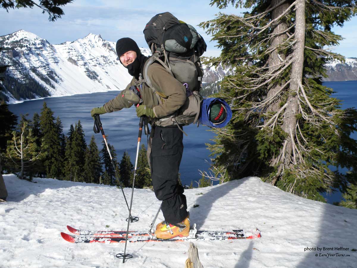
45 pound packs.
About 100 people a year jib around the lake. 70 skiers and 30 snowshoers. Crater Lake is the deepest lake in the United States and the 7th deepest lake in the world. It is filled only by rain and snowfall; an average of 66 inches of rain and 44 feet of snow per year. No streams or springs feed into the lake. It took 250 years for the lake to fill with water. Over a thousand feet deep, it is one of the cleanest and purest lakes in the world. The water clarity has been recorded at a record breaking 142 feet.
The average height of the caldera rim is just over 7,000 feet with Mt. Scott being the highest peak in the park at 8,929 feet. The lake is 6.02 miles wide (east-west) by 4.54 miles (north-south). The route follows Rim Drive, the road around the lake, making the circumnavigation 31 miles long. Most people take 3 days to do the trip. Cross-country ski racers complete the route in under 8 hours.
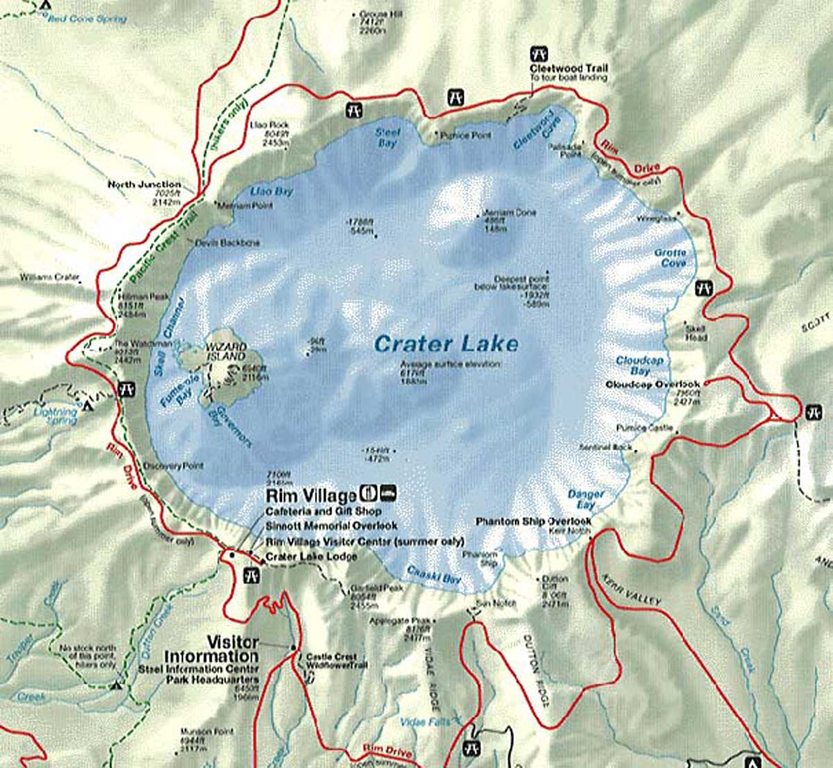
Map view of Crater Lake and major landmarks.
We started out heading clock-wise around the lake. Two hours of skiing brought us to just past The Watchman. A small group of trees would be our home until Friday. Winds were predicted to be 40-50 mph on Thursday. We found some good protection for the tents and settled in. The winds arrived later that night as predicted. Not much snow overnight. The wind could be heard racing over the tops of the trees, but the ridge we were on deflected most of it. Our camp spot was perfect.
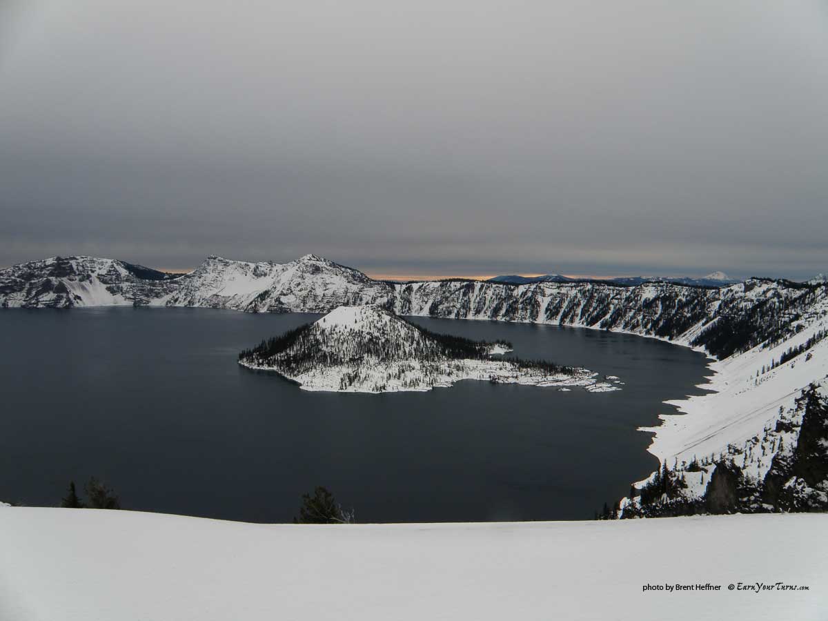
Wizard Island just before The Watchman.
We slept well overnight. On Thursday we woke, then went back to sleep. The weather outside was nasty so we pretty much slept all day. Just beyond our little group of trees, the wind tore away at Hillman Peak, the highest peak on the rim, on our left and The Watchman, to the right. Towards the end of the day, it looked like it was starting to clear up. The wind had died down and we took advantage of the break in the storm to walk around. Any loose snow was now in the lake. We were camped in the middle of an ice field.
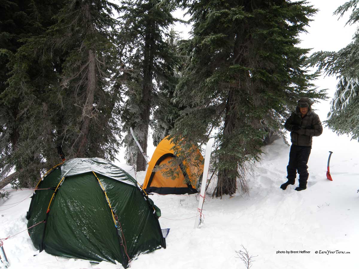
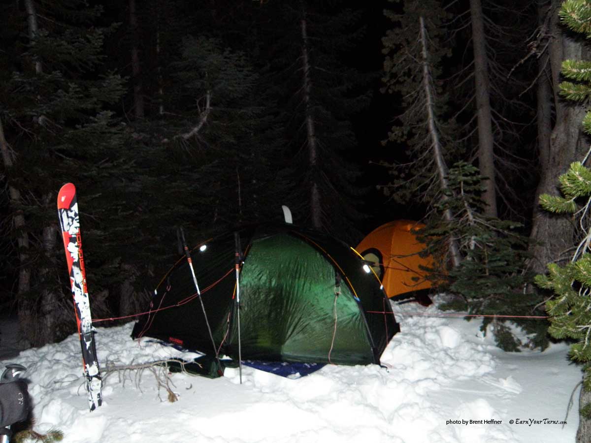
Camp I
Walking around was tricky. My North Face down booties weren’t much help on the ice, I was slipping and sliding around. At one point, I walked away from the trees onto the ice. I was about 50 feet from the trees in a large opening or meadow. Suddenly, the ice beneath me dropped with a loud WHOMP! I could hear cracks shooting out in all directions. My heart jumped and I started running back. Well, I tried running. I wouldn’t have thought the slope was steep enough to slide, but it was too steep to run with my choice of footwear. Only about a 20° slope, but I wasn’t sticking around to test any theories. Two more loud WHOMPS! were heard as I frantically and gingerly made my way back to the trees across the slippery slope.
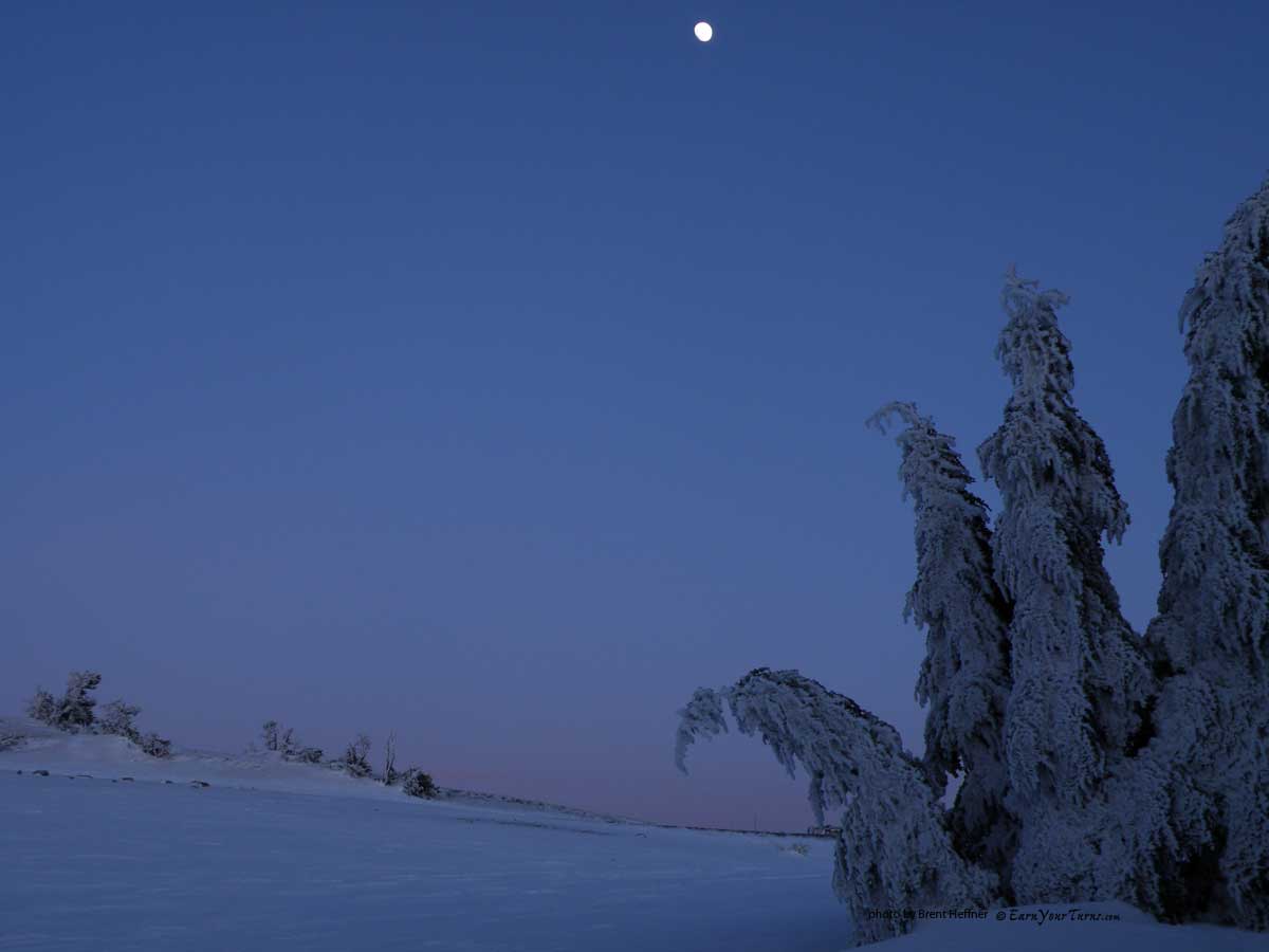
Moon rising over camp.
By the time I got to the trees, which seemed to take forever, I had gained momentum. I didn’t take into account the fact that the snow was grippier here. Two or three strides into the trees I fell flat on my ass. Safe and unharmed but with my heart still racing, I looked back at the slope. It hadn’t moved. I tucked myself back into my -30° down sleeping bag, prepared dinner, and we spent one more night in the trees.
Friday dawned cloudy and windy. Getting back up to the road was challenging. The ice was bullet-proof. Too stubborn to use our skins, we sidestepped and edged up the slippery slope. What should have taken maybe five minutes, took almost 30. We had gotten up early. I struggled and edged my way up the the crater rim to catch the sunrise.
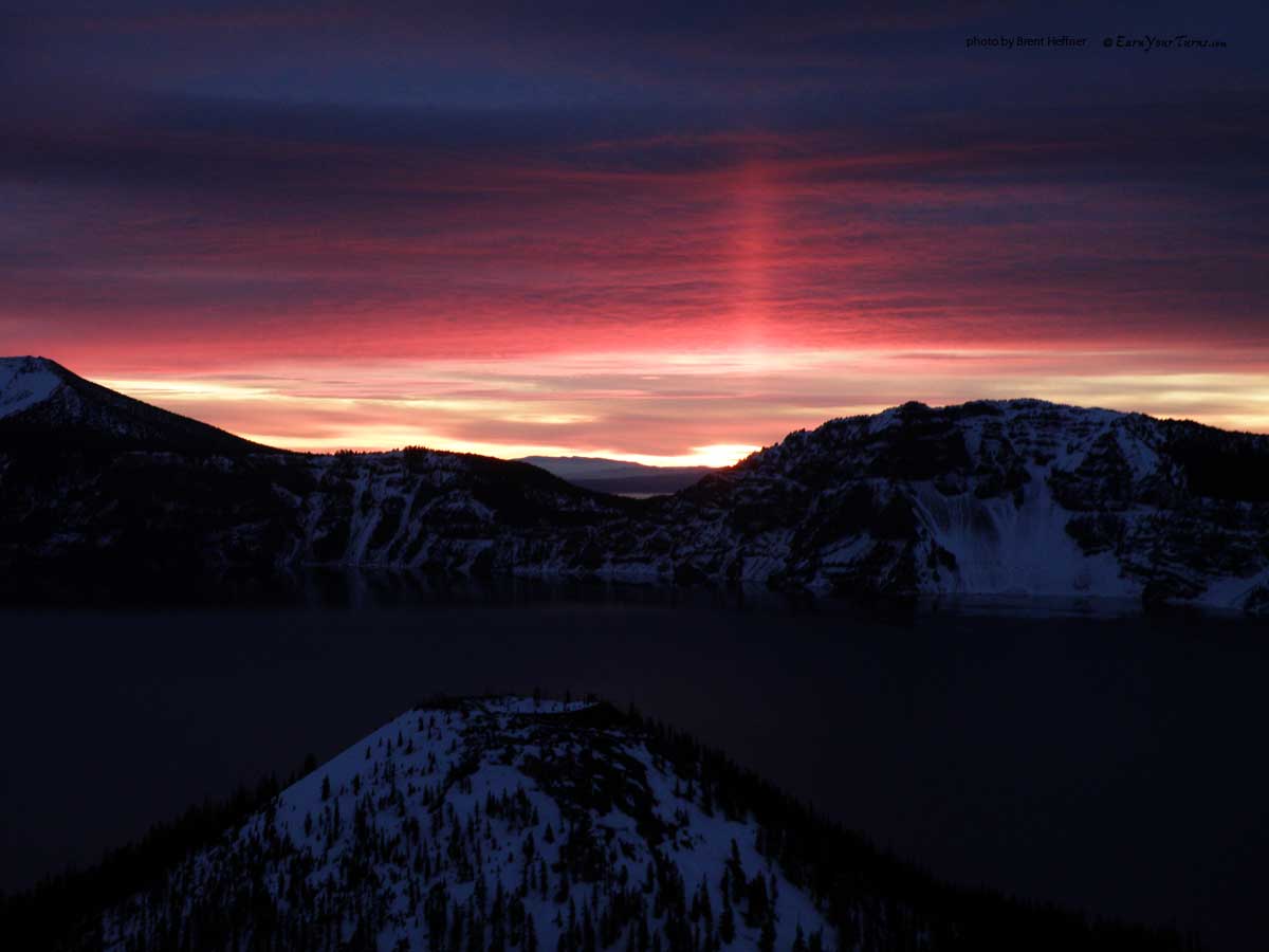
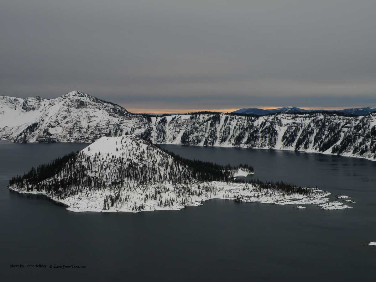
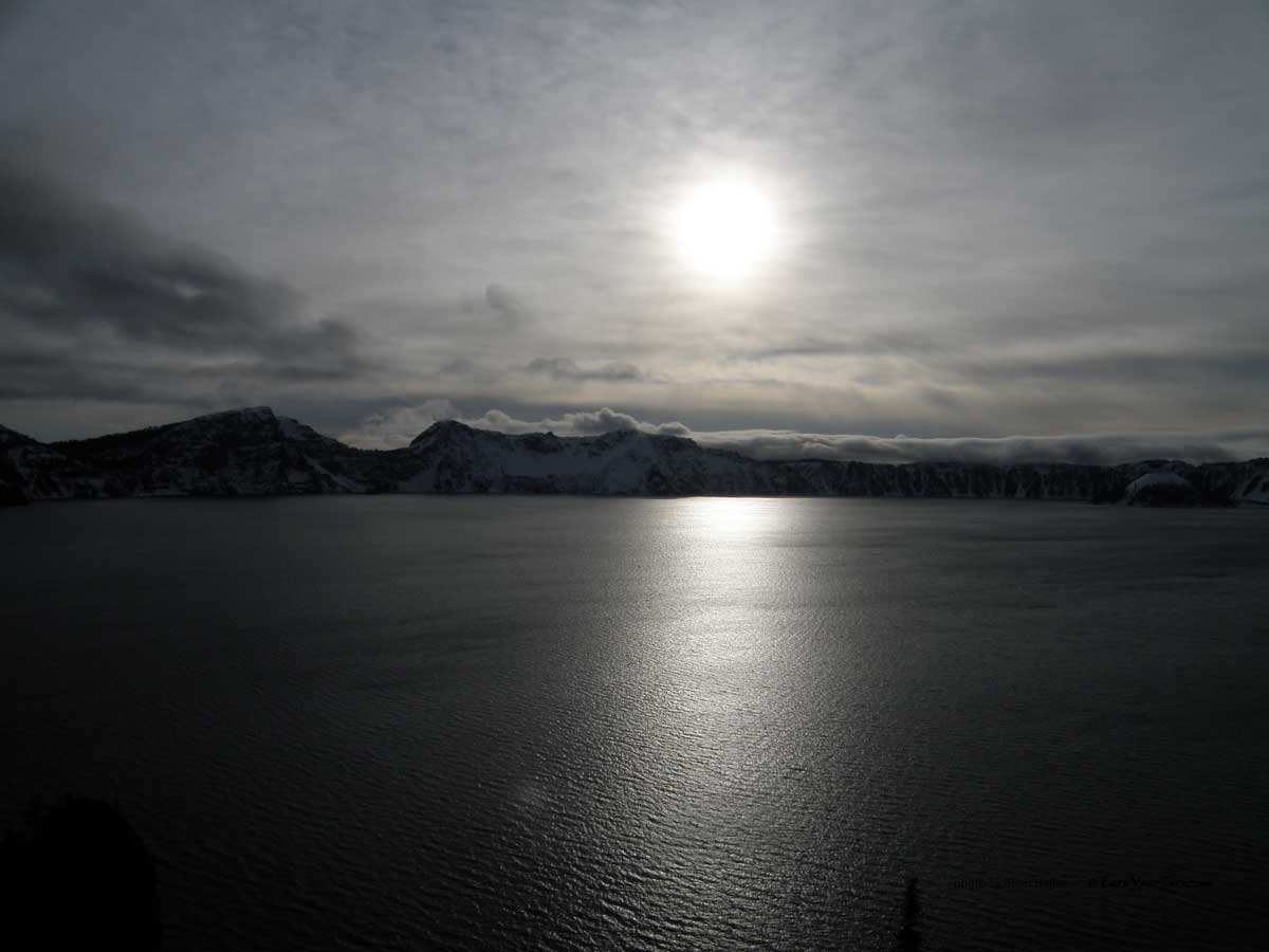
Sunrise over Wizard Island.
Now the trip was starting. We had only skied about 3 miles on Wednesday. The storm on Thursday was expected so we were still on track. My GPS watch wasn’t holding enough juice to keep track of the miles and I had left all the info and maps we got from the rangers in the Jeep. I did have my topo map though, so we were able to get somewhat of an idea of how many miles we traveled each day.
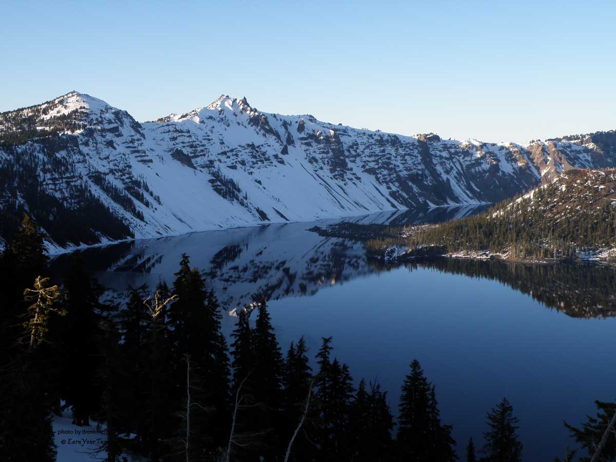
Mark on the ice. Llao Peak on the left.
The hours were easy to keep track of, so we just watched that. The plan was to stop each day at 3pm, two hours before sundown.
We now had three days to travel the remaining 28 miles. The snow soon got better. We made good time and saw no other tracks for the rest of the trip except for one set of ski tracks. We would follow this set of tracks the entire way around. One track, no stops or camps, except for a few places where the the skier probably paused for a water or food break. With this unknown jibbers tracks for inspiration, we jibbed on.
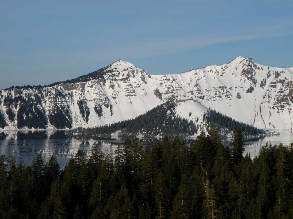
Merriam Point overlook.
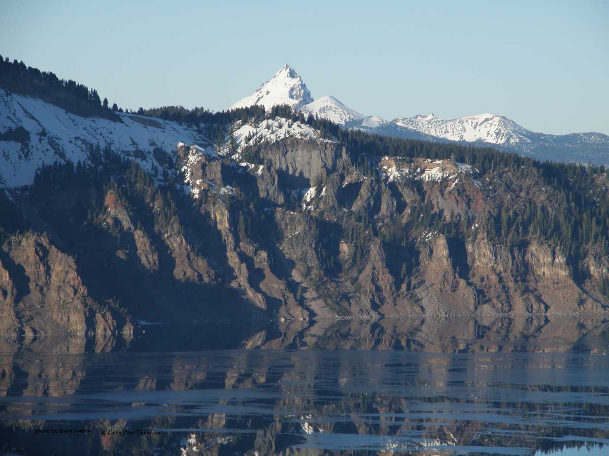
A little zoom.
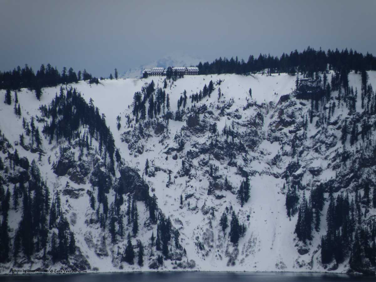
20x zoom - Rim Village
Hardly any creatures. Only saw one bird, a raven. Only a few rabbit and squirrel tracks and the occasional coyote track. Didn’t see any of the creatures that made the tracks. We had the place to ourselves. The ice layer was with us the entire time. Slide one ski forward and weight it. Only to have it suddenly break through the ice layer and into the sugary powder beneath. The annoying ice layer was a small inconvenience. We had world class views all day long. The sun was hidden behind the dark clouds, keeping the snow cold.
A little video taken from the viewpoint just past Pumice Point:
Crater Lake – January, 2012 from jibmaster on Vimeo.
My goal was to get to a place called Wineglass. We skied along following the ski track along the snow covered road. The wind had died down by afternoon and we were able to put the hard shell back in the pack.
The view from Palisade Point.
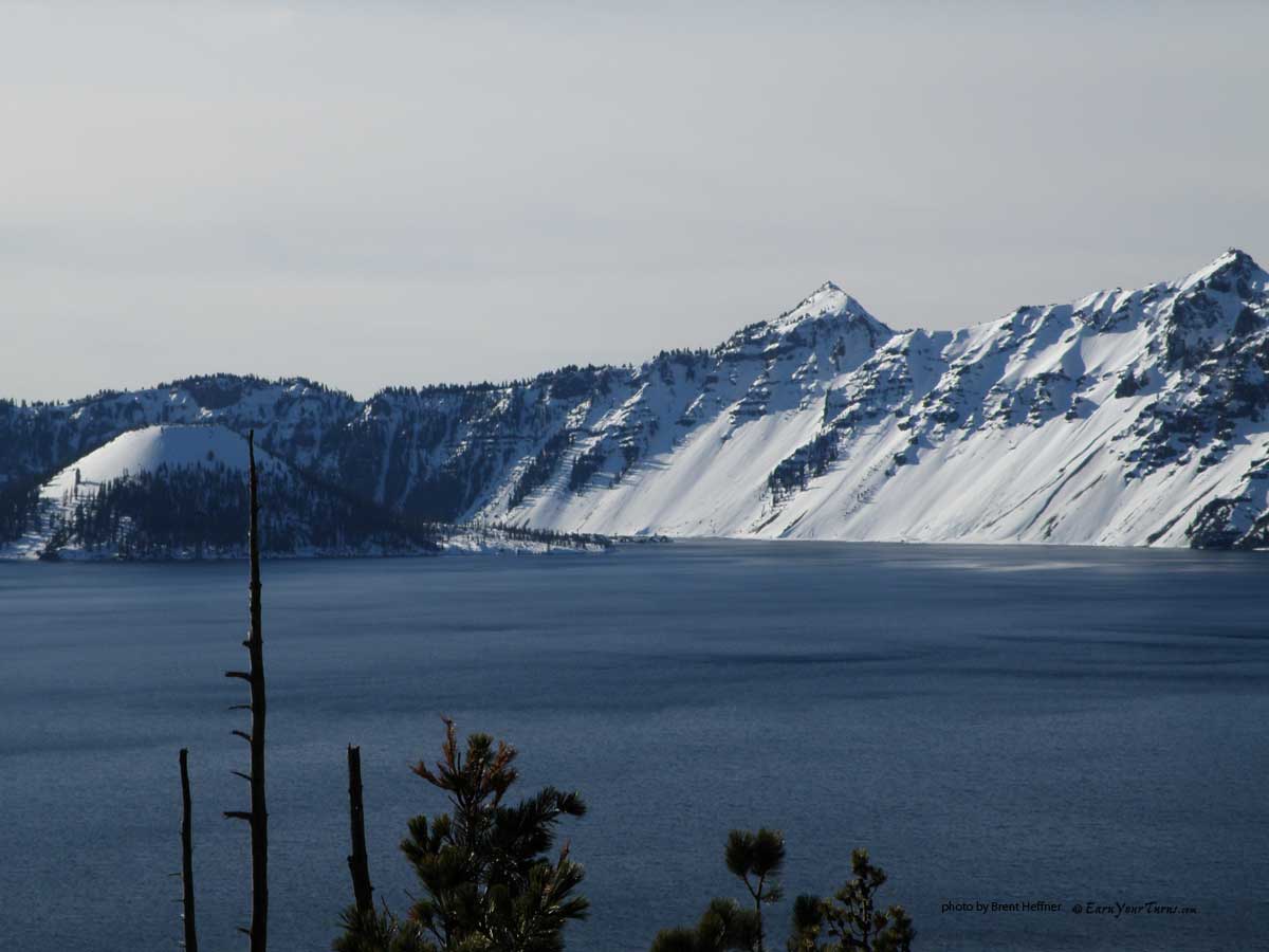
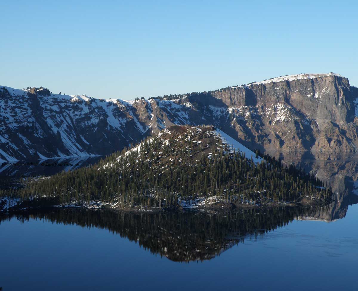
Close up view of Wizard Island and The Watchman.
Wizard Island, The Watchman, Hillman Peak, Llao Rock.
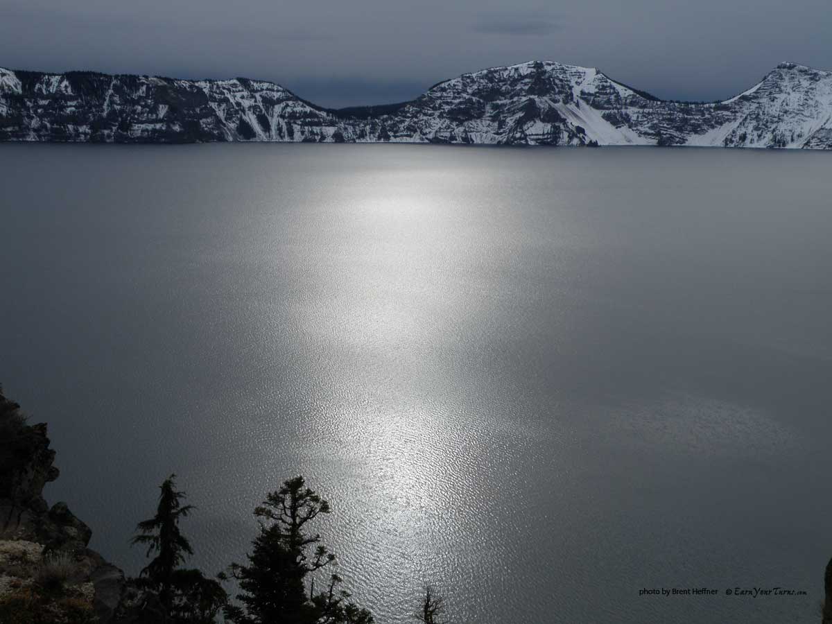
The round orb of the sun over the round lake.
We arrived at Wineglass by 2pm. It felt like we were almost there. We had gone almost halfway around on our first full day of travel. But knowing that the road leaves the crater rim and winds it’s way around with plenty of climbing yet ahead, we stopped.
We were now on the eastern side of the lake. Very little snow here. We had to take off our skis and walk certain sections. 10 feet here, 50 feet there. We set up the tents on dry ground. I had spilled my water earlier in the day and finding good, clean snow to melt for water was a challenge.
It had started to snow again by early evening. I awoke in the middle of the night to find I was out of water. The best snow for collecting was around the tents. The snow would hit the tents and slide off. So I harvested all the little drifts around both tents. It was a very slow and tedious process.
Saturday was clear and sunny. Just a bit warmer as well. There was just enough accumulation to allow us to ski across the spots on the road that yesterday, were bare. We were about to leave the lake and start climbing the 800 feet to the shoulder of Mt. Scott.
Looking out from Skell Head.
The snow started to get deeper. Our camp at Wineglass was at 6800′. We climbed up the road to just over 7600′. Still no need for skins. The scales gripped very well. But the consequences of breaking through that annoying crust was now 5-7 inches. Slide one ski forward, weight it and watch it slide back. With no views of the lake for hours, we put our heads down and jibbed on.
We cut across the open meadow below Cloudcap. Very windblown and icy here. We were pretty beat. But we had some downhill coming up.
Back on the road, all we had to do was stand there and let gravity do it’s thing. Down the road we skied, grateful for the assistance. Around Pumice Castle and past Sentinel Rock. My legs were killing me as we headed into one more downhill. The road straightens out here and I finally called it for the day at 7400′.
Camp III.
It was Saturday night. We were too tired to cook anything up for dinner. So we just ate our lunch and snacks.
It didn’t take long to fall asleep. We had skied 7 hours on Friday and 6 hours on Saturday. We are now getting close. One more day should do it.
We still had the remaining downhill around Dutton Ridge. We were 1000′ above Park Headquarters and the end of the route.
Mark's down with it.
Sunday arrived with more sunshine. We packed up camp and skied on down the road. Not quite steep enough to coast, but at least it was downhill. The snow was deeper here and we had to work our way around some deep drifts. We weren’t sure if we would see the lake again. It was hard to tell from the topo map if there were any visuals left in our tour. This was definitely the warmest day. And we were still following the same ski tracks that never seemed to stop. It appeared to be all downhill from here.
We actually did get one more view of the lake through Sun Notch. The Watchman is on the left and Hillman Peak on the right. It’s now Sunday and we could see where we first camped last Wednesday. The sunrise picture I had taken Friday morning from between those two peaks seemed like a lifetime away.
One last view of the lake through Sun Notch.
It didn’t show up very well on the topo map, but there was one last climb. Under the ominous Vidae Cliff. There is an avalanche detour that stays lower and avoids skiing directly under the steep, rocky cliff that rises several hundred feet right off the road. It was still morning, so we took the chance. But the cliff faces east and was warming up fast. Natural slides were probably not going to happen, but if the sun warmed up and loosened a big enough rock, we were skiing right through the landing zone.
Evidence of snow and rock that had been displaced from high above lay about the road. We kept on the far side of the road, which greatly increased our safety due to the location of the debris. Then we started to clump.
30 minutes of toiling up the wet road with worrisome glances to our right and up, brings us around the corner to safety and another 15 to the top of the hill.
Now it really is all downhill. 2 miles of it. The day was warming up fast, the snow wasn’t fast. Neither were we. Slowly slushing and clumping our way down the road. These Oregon miles seemed to go on forever.
But finally, after 6.5 hours, I arrived at Park Headquarters. Mark was suffering from blisters, so I had gone on ahead to retrieve the vehicle. The route ends 600 feet below the crater rim. Rim Village is three miles up the road. There is a route to skin up, but I wasn’t in the mood. I was planning on catching a ride.
Only 1 car in the parking lot when I arrive. California plates. Eight minutes later, I found the owners and got a ride. I was too tired to get the names, but you know who you are. Thanx!
Drove down to pick up Mark, who had arrived 15 minutes after I did. Then drove back up to the crater rim to get a few last shots.
Wizard Island and Llao Rock.
Another view from Rim Village.
Mt. Thielsen.
Wizard Island and Llao Rock.
What a great place! The trip was perfect. Not only was it just what I needed, but it went exactly as planned. I will most definitely be back.
Full collection of photos from the trip..
© 2012