
Home turf for the CCSP
click to enlarge
The Coastal Crest Snow Patrol (CCSP) consists of a group of friends that have spent the last couple decades exploring the possibilities of getting turns on the snow-covered peaks of the Mendocino National Forest.
I first discovered the skiing here with my good friend Eric Heim (sirjibalot). We got our first turns in the Coast Range on Hull Mountain back in the mid 90’s. We were amazed at the depth of the snow, the 1000′ of vertical and the steep terrain.
We would drive up to Hull in the Jeep almost every week. Camping out in storms, 4-wheeling and exploring the different bowls and ridges. We eventually started to name all the runs at Hull.
Here is a link to a Google Earth map of Hull Mt. with all the named runs.
https://www.sonomawings.com/ge/ski-hull.kmz – Thanx to Ernie at sonomawings.com for help with the map.
The original members of the Coastal Crest Snow Patrol, along with myself and Eric, are James Anzalone (janzalo), Scott Cooper (jibC) and Mark Chon (snowblasta). We eventually started to jib out to other peaks in the Forest.
Over the years, word as gotten out and the CCSP has grown. There have been several folks who have joined in on some of my trips. If you go with me, or do a trip on your own in the Mendocino National Forest, you are an honorary member of the Coastal Crest Snow Patrol.

Lake Pillsbury from 5500' on Hull Mt.
The southern portion of the Forest is accessed by Hwy. 20. Hull Mountain sits just north of Lake Pillsbury. From the town of Upper Lake, there are two ways to get there. Google Earth likes the route through Potter Valley. This is the best way to get there when the snow levels are really low. The route up and over Elk Mountain (el. 4180) can have snow up to 4 feet deep.
Hull Mountain is 6873′ tall. Steep slopes on the west and south side offer 1000 vertical feet of super smooth corn snow all winter. The summit ridge heads east where more slopes, ridges and bowls offer even more ski runs. Popular with 4-wheel drive enthusiasts, the access road (M1) is often punched in with tire tracks, making the summit easier to reach for those with skis or boards. A Jeep helps here.
Hull Mountain from the top of Elk Mountain – Lake Pillsbury buried in fog.
The southern most peak, Snow Mountain, can also be accessed from highway 20 using Bear Valley Rd., right across the street from highway 16. Or from the town of Willows via highway 162 on the I-5. The town of Stonyford is located here. Access in midwinter is difficult. Snow covered roads guard the mountain for many miles. By late April or early May, the roads have melted off a bit and the summit is reachable in a day trip.

Heading home from Snow Mountain
This mountain is huge. Often referred to as a sky island. Two main summits, Snow Mountain East – 7056′ and Snow Mountain West – 7038′ sit in the middle of a sea of ridges and bowls. From the Summit Springs trailhead, one run down the north-facing, 900-foot deep Stony Bowl will take all day. I named it for the headwaters of Stony Creek which snakes along the north side of the mountain. Long runs exist on almost every aspect. The sea of ridges, peaks and bowls surrounding the two summits is around 8 square miles. Highway 101 runs along the west side of the forest and accesses the town of Covelo in Round Valley via the 162. Anthony Peak (B), Mendocino Pass and Black Butte (C) are located here.

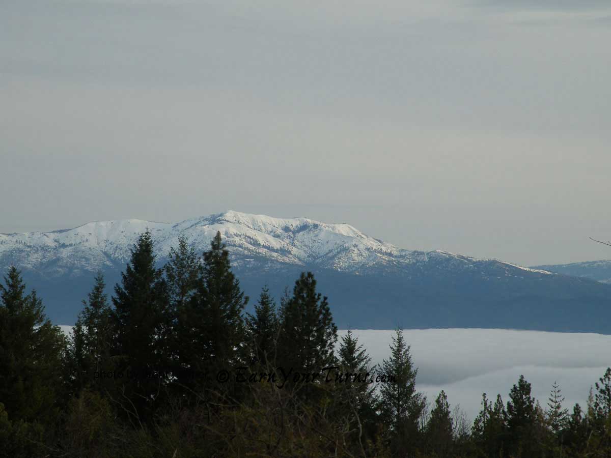
Looking up from the road to 'Weather Station Peak'
Mendocino Pass is right in the middle. Lots of good lines above and below the road, which winds around below the ridge and finally meets the ridge at the Pass. Over three miles of lines come off the ridge and down to the road. Turning left (north) at the Pass takes you about 4 miles to Anthony Peak (6958′). Or continue on south (right/straight) for about seven miles to Black Butte (7455′).

Steep terrain at Black Butte
Black Butte can also be accessed from highway 5 using the 162 from Willows. But the road is not plowed past Alder Springs. The road from Covelo to Mendocino Pass, the 162, also known as FH7 (Forest Highway 7), is kept plowed to just about a mile before the Pass. Very good access here. This is all private property. The summit of Anthony Peak is privately owned. But the locals are more than happy to share their terrain. They are not big fans of snowmachines and will be much more willing to allow access if you’re willing to earn your turns silently.
More photos and directions on the next page…
About to descend into Round Valley on Hwy. 162

Looking down into Round Valley Hammerhorn Peak in background
Looking north from Mendocino Pass to Anthony Peak.

Anthony Peak
And the view of Anthony from the north. This picture was taken from South Yolla Bolly (Mt. Linn). You can see Sanhedrin Mountain and Impassable Rock in the background.

Anthony Peak from South Yolla Bolly
At the northern end of the Forest the is the Yolla Bolly- Middle Eel Wilderness. North Yolla Bolly and Black Rock Mt. are the two main peaks. Highway 36 is the access road here. The last sign of civilization is the little ‘town’ of Wildwood. An overpriced gas station and cafe sit in the middle of the woods. There is no menu, just order whatever you want – and the old guy behind the counter will make it.

Looking north from South Yolla Bolly - Black Rock Mt (L) and North Yolla Bolly (R)

The north face of Black Rock Mt.

The north face of North Yolla Bolly
South Yolla Bolly (8094′) is the tallest peak in the Mendocino National Forest. Only accessible two months a year. There is a gate controlled by a logging company that is closed December through April. This gate is 15 miles from the mountain. The gate is opened on May 1st and closes December 1st. The gate is located at 4000 feet at a place called Franklin Point on Valentine Ridge.

South Yolla Bolly from Valentine Ridge
Formerly known as Mt. Linn, this mountain is an east-west ridge with two peaks. The north face off the summit falls away almost 1000 feet, down to Square Lake. Two bowls drop off the summit. I have named the bowl dropping down to the lake, Square Bowl. Access is from the I-5. Either from Red Bluff or Corning. The entrance from Corning is easier and about 30 minutes shorter.
Google Earth likes the route that’s only available in the summer. The best way to get there is to take road A9 west from Corning towards Paskenta. Just before Paskenta, turn north (R) onto Lowrey Rd. This is a smooth gravel road. Take it to Colyear Springs Rd. Turn left (west). This will turn into road M22. Follow the signs to the Ides Cove trailhead. The snow in the Mendocino National Forest is very unique. Unlike any snow I’ve ever skied. The proximity to the Coast along with the lower elevations of these mountains keeps the snow pack more stable than elsewhere. The snow levels fluctuate and the strong California sun bakes the slopes, creating Spring-like conditions all winter.
The Yolla Bolly’s are farther north and taller, thus receive drier snow than the peaks to the south. While deep powder days are rare, the corn can’t be beat! Super smooth corn forms anytime the California sun comes out. Suncups are almost non-existant. The corn window is also unique. Early in the day, the snow is rock hard. By the afternoon, the snow is usually too soft to ski. However, it all depends on the temperature/wind/time of day/or year(angle of the sun) and the aspect of your chosen run. High clouds will hold the snow on any aspect all day. Or one can follow the sun from east to south and finish up the day with a western descent.
Hull Mountain has the best access to every aspect on the compass. The past two decades have only strengthened my resolve to explore these mountains even more. The more I discover, the more I realize I have not even begun to scratch the surface of what’s available here.
More resources on the next page…
Resources:
Trip report links:
Hull Mountain(100’s of photos): https://www.thebackcountry.net/bb/viewtopic.php?f=2&t=138&start=40
Anthony Peak https://www.thebackcountry.net/bb/viewtopic.php?t=398
Mendocino Pass https://www.thebackcountry.net/bb/viewtopic.php?t=1335
Snow Mountain https://www.thebackcountry.net/bb/viewtopic.php?t=342
Black Butte https://www.thebackcountry.net/bb/viewtopic.php?t=356
North Yolla Bolly https://www.thebackcountry.net/bb/viewtopic.php?t=588
South Yolla Bolly https://www.thebackcountry.net/bb/viewtopic.php?t=1773
Weather links:
Noel Springs – located at 5000′ near Snow Mountain. https://cdec.water.ca.gov/cgi-progs/queryF?NLS
More detail for Noel Springs – change the date:https://www.nohrsc.noaa.gov/interactive/html/graph.html?station=NLSC1&by=2011&bm=11&bd=18&bh=06&ey=2011&em=11&ed=25&eh=06
Google Earth/NOAA snow depth/coverage:
https://www.nohrsc.noaa.gov/earth/
Sheet Iron Mt. – 6500′ – just north of Snow Mt. https://cdec.water.ca.gov/cgi-progs/queryF?SH1
Anthony Peak – weather station on the summit(scroll down) https://www.coveloweather.info/ Snow Mountain weather https://www.findlocalweather.com/pinpoint/us/ca/snow+mountain+wilderness/current509735.html Weather Discussion https://cdec.water.ca.gov/cgi-progs/weather/SFOAFDEKA
Fire Imagery website – only good when it’s clear:
https://activefiremaps.fs.fed.us/imagery.php?op=fire&fireID=ca-north-000
Alder Springs:
https://cdec.water.ca.gov/cgi-progs/queryF?ADS
© 2012